

Last week we invited you to the roundtable on ICTs and public space, which unfortunately was interrupted by a hacker attack. The conversation continued in private mode, reserved for speakers only.
To try to remedy the incident, in the coming weeks we will post their contributions in video format, while today we’ll go on with the debate here, sharing with you what we wanted to “put on the table” and share with the audience, starting with a question. It is clear that ICTs affect the use of public space, but how can they narrate the space and give it a voice? Can they get the city to talk?
We found an answer: FirstLife, the civic social network made in Italy. It’s the result of a University research project and of the cooperation with citizens, and it’s a communication tool for the city and for the public space: in simple terms, it’s “the facebook of the territories, but it’s even better!”
Turin (Italy)
7th of December 2021
time of reading: 7’ 10’’
Let’s go ahead, step by step. What is a civic social network? It’s an ICT that uses the functions of social media, among others, the creation and sharing of content, photos and images and the activation of chat and networking, but which, unlike these, does not aim to celebrate the individual, but the construction of a community and the participatory narration of its territory. A civic social network, in fact, encourages the exchange of information and content of public utility (stories, events, places and activities) free from any market and advertising logic. Therefore, it has no interest in user profiling and data collection and guarantees neutral communication, which is very rare these days.
FirstLife is one of the best Italian practices. Developed by the research team Social Computing of the Computer Science Department of the University of Turin, it’s one live instrument which constantly evolves thanks to the co-design with the same users who, with practice and application in different fields, make suggestions for new functionalities and technical solutions. There is another feature that differentiates the Turin civic social network from the others: the contents can be georeferenced and therefore the users not only talk, but give life to maps collective and narrative that become very powerful tools of communication and planning of and for the territories. FirstLife is composed of a bulletin board (newsfeed), with some social functions through which you can create cards and share the content (the correspondent of a post), and of a synchronized map that geolocates the cards and their information, giving a common and multidimensional geography of the territory. It creates a narrative cartography where you can find stories of places and groups, project results and new proposals, polls, dialogues and much more.
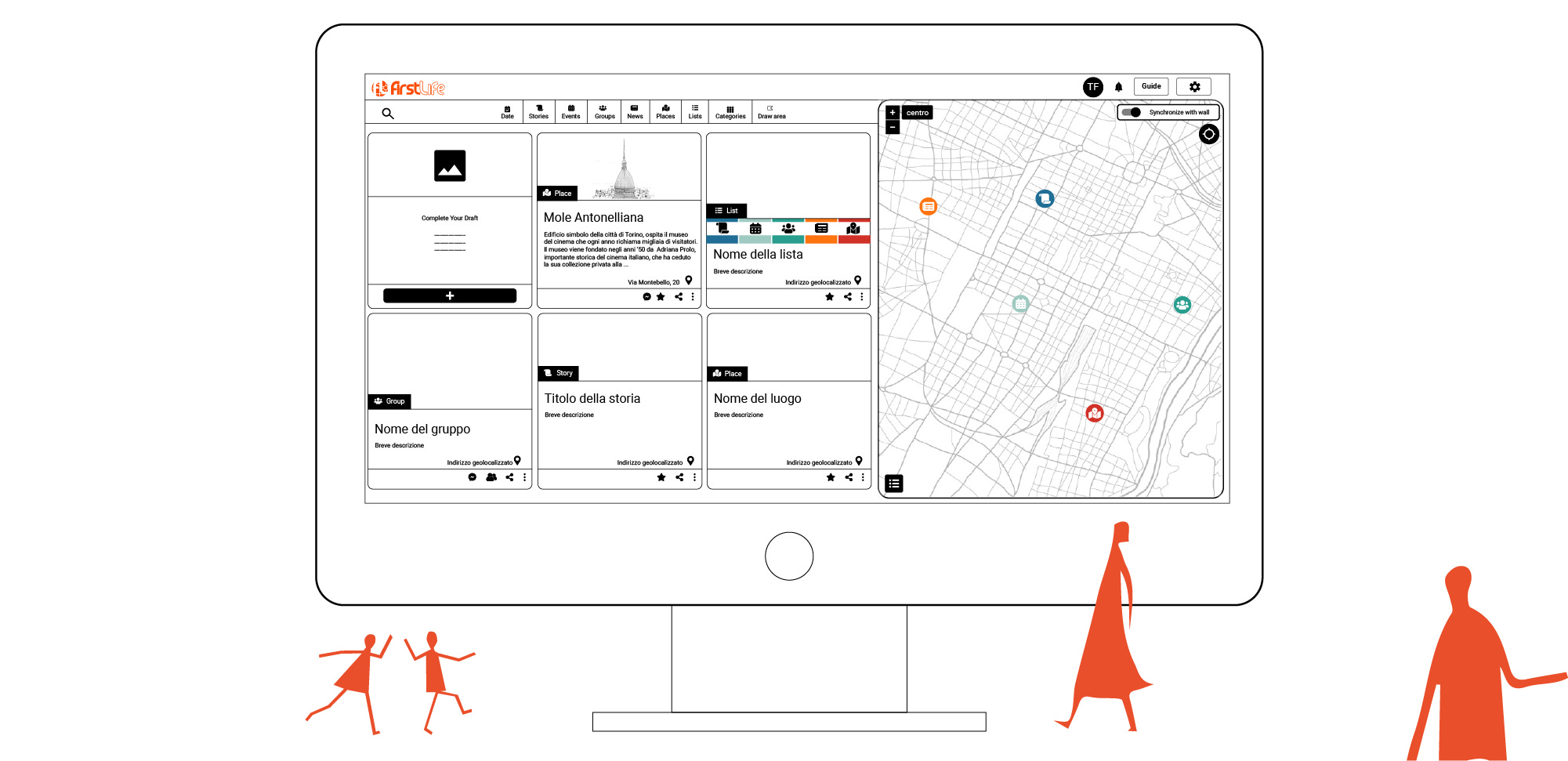
This link between virtual and physical reality is what makes this communication tool so extraordinary. It becomes an extension of collective life by keeping it anchored to the physical space, thus helping community members to strengthen the sense of belonging to the urban environment and allowing people to consolidate their identity linked to places that they can actually cross, (re)name, tell, structure and transform into a territory to take care of.
It looks like pure philosophy, but instead it is extremely concrete. FirstLife is an open source tool that works as a responsive web app, for both desktop and mobile. It’s a kind of digital forum where to propose ideas and projects that, instead of getting lost in the network, are fixed in a predefined context and are freely accessible at any time, without falling into obsolescence as happens in uninterrupted flows of digital communication channels that drag and disperse tons of information. Sharing contents of public utility by fixing them to the geography of the territory gives citizens the opportunity to acquire awareness, to work on common goals and commitments, to focus on the problems and, also, to witness the real success of public, educational, research and innovation policies and of keeping track of their daily history and their actions.
FirstLife features can be customized according to specific needs and projects. Over the years numerous Public administrations and institutions used FirstLife to involve citizens in decision-making processes for the redevelopment and regeneration of urban spaces and for reporting critical issues; many associations of neighbourhood and the foundations which involved the inhabitants in processes of co-planning and safeguarding of common goods; many schools and the educational and training realities that involved students, teenagers and very young people in the mapping of their reality and their needs. Finally, more recently, in the field of international cooperation some applications of FirstLife took place, with the involvement of the citizens in processes of fundamental importance, such as sustainability and the equitable redistribution of resources. All these different applications of the tool have shown that citizens are the main actors, creators and modifiers of their physical and digital territory and that, thanks to ICTs, it is possible to move from the individual to the community sphere, allowing the activation of synergistic processes of creation of “wiser” cities, capable of putting citizenship at the centre.
To understand more of the potential of this tool, we selected some maps and boards that we invite you to explore:
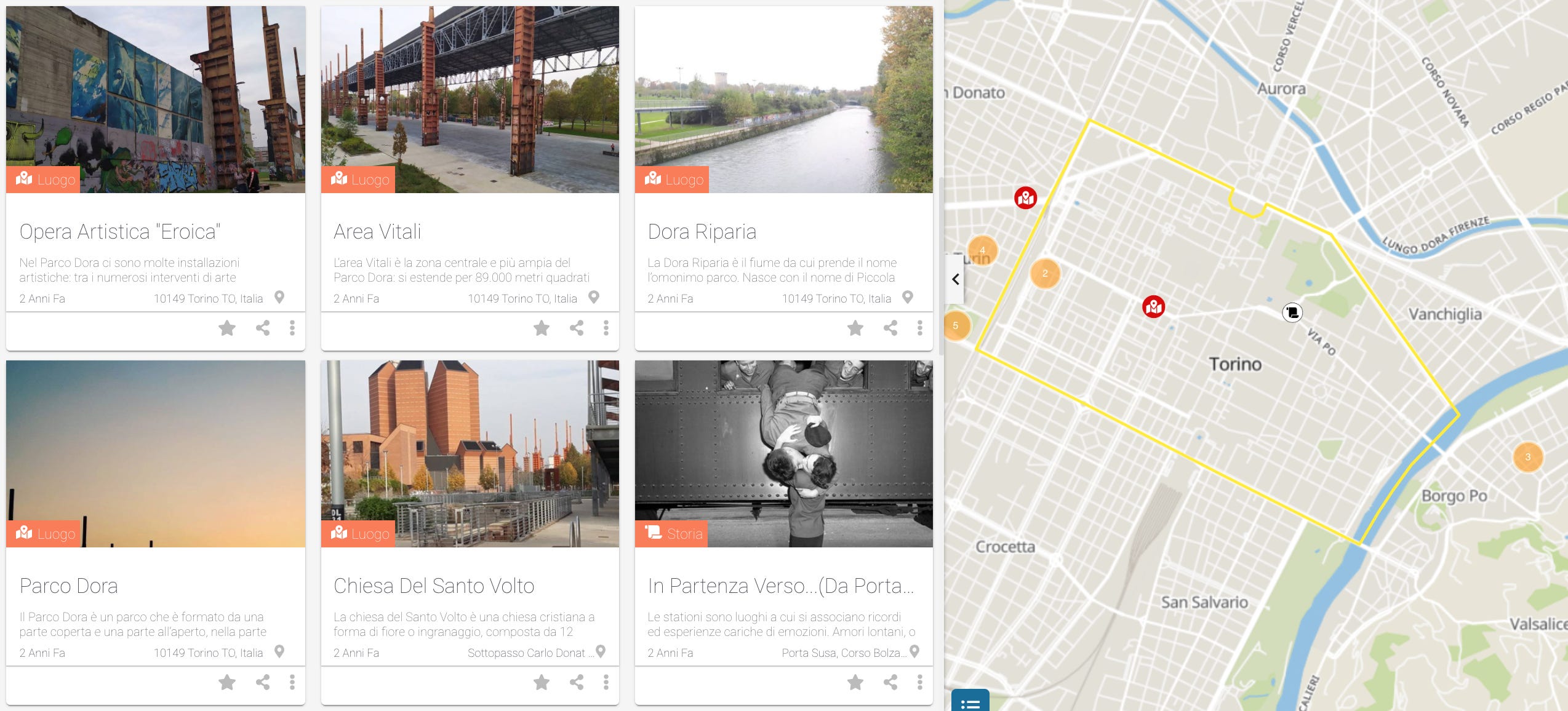
The Cultural Heritage of the cities are often unknown to the citizens themselves, who are rarely given the opportunity to share memories and to act as protagonists in their artistic-cultural reality. The Municipality of Turin has decided to change this, starting from female students, involving them in a project of mapping, narration and promotion of the historical, artistic and cultural heritage through the adoption of a monument, thus encouraging their role as tutors who are aware of the urban environment.
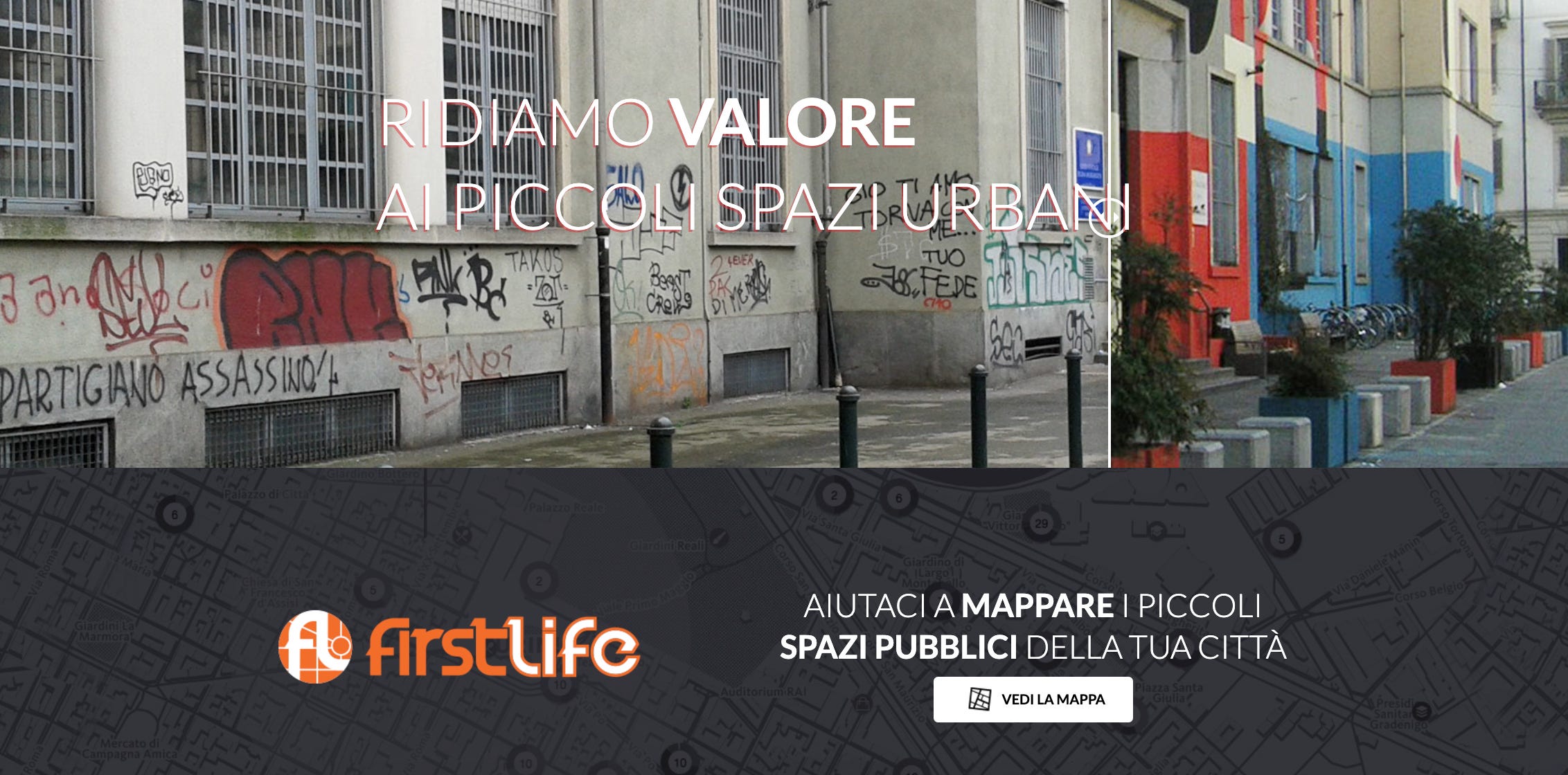
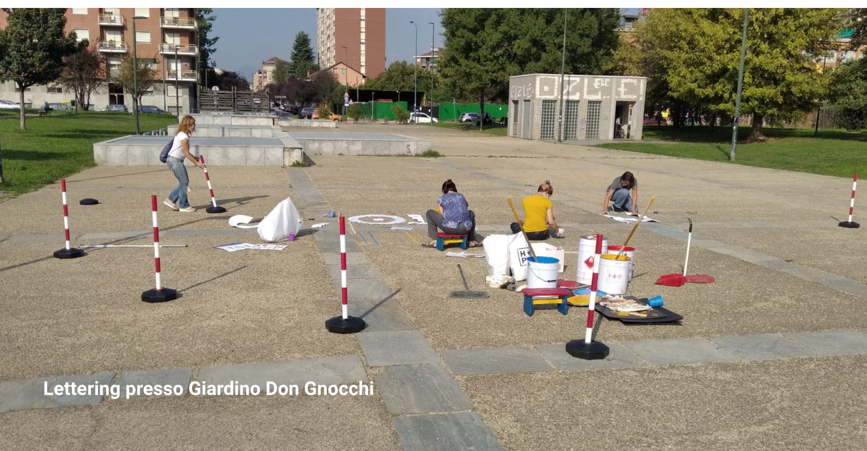
Promoted by the association Laqup, in collaboration with six different municipalities in the province of Turin and with the involvement of schools and citizens, the project creates a network of resources to give value to small urban spaces, such as gardens and squares, on which the quality of life in the city depends.
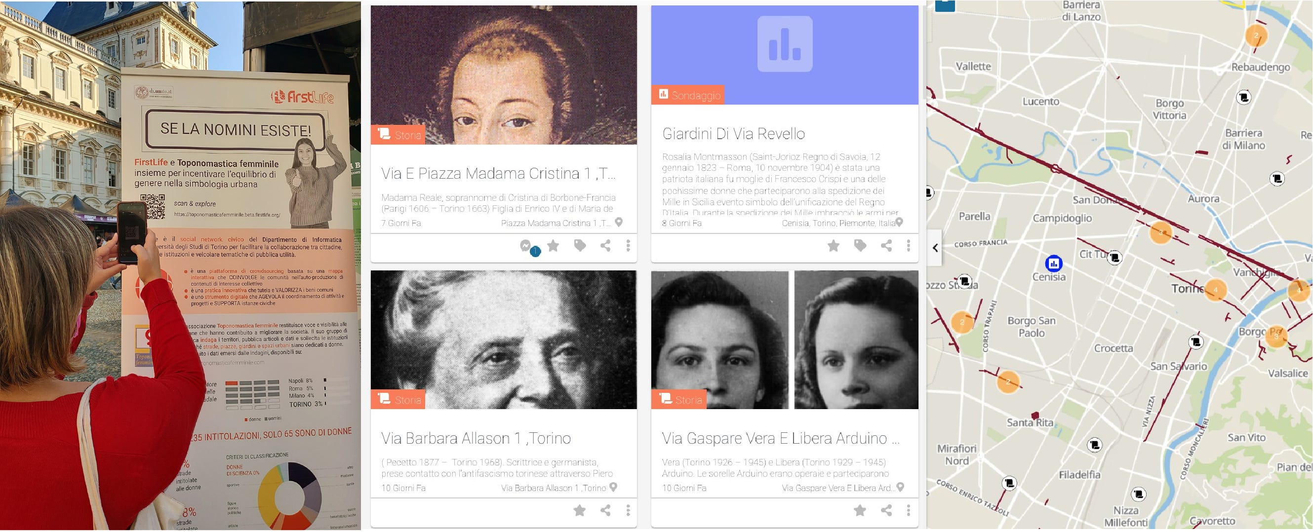
Only 5% of urban places are dedicated to female figures, a percentage that tells a lot about the discrimination that women suffered throughout history; for years, the association Female toponymy has been committed to raise awareness, starting from a bottom-up mapping of female titles extended to the whole national territory; a few months ago it adopted FirstLife to map the city of Turin and promote polls for naming proposals.
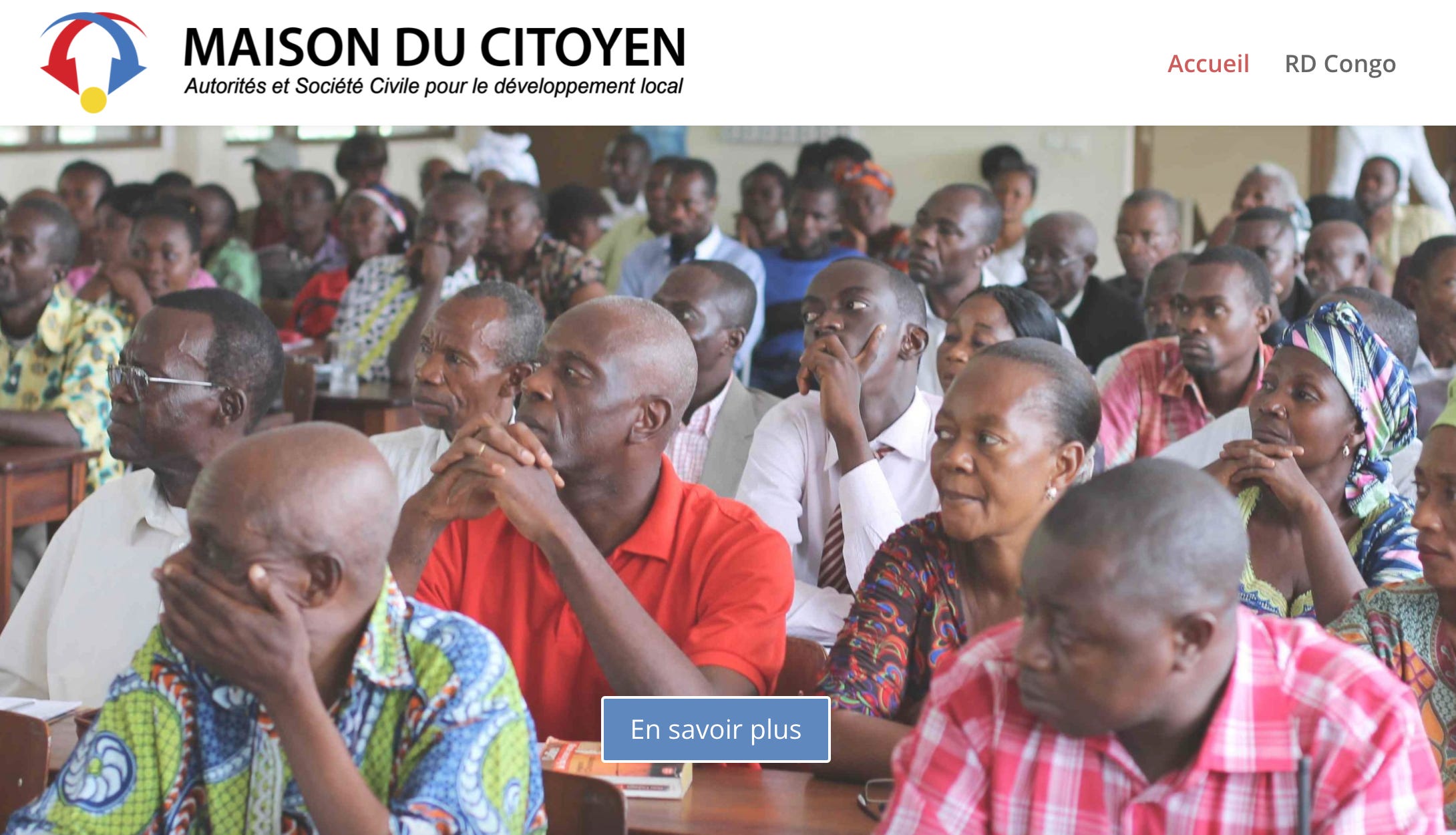
For ten years, the Turin association Equiliberi Onlus has been working in the Democratic Republic of Congo to improve the redistribution of public resources in favour of the most vulnerable populations. Starting from 2020, it adopts FirstLife to map municipal public investments, aimed at improving accessibility to drinking water and healthy sanitation systems in schools, hospitals and public markets, and to directly involve organized civil society in their monitoring.
These are different practices that come together in a single result: highlighting the existence of an active citizenship that deserves space, voice and places of expression, which knows what it wants for its territory and its city, which is moved by the desire to know, deepen and participate in the history of one’s community. And finally, there is one technology at your service.
There are no more excuses, let’s give a word to the city and to those who live in it!
Note: The FirstLife research group is available to receive and develop new proposals in collaboration with groups, designers, territories: it is an open source, customizable and free, for projects of common interest. To get in touch with the team directly, just write to info@firstlife.org or send a message to their Facebook page.
If you’ve read this far… THANK YOU!
If you liked this post, why not share it?
and if you have any comments or suggestions, write us!
See you for the next Postcard!